Plantation & Forestry

DJI Matrice 4 Enterprise
The DJI Matrice 4E is DJI's latest enterprise drone designed specifically for high-precision geospatial mapping and surveying...
More
Terrasolid – Post Processing Software
Terrasolid is a professional software for large-scale LiDAR data processing and analysis, widely used in topographic mapping, corridor mapping, forestry, electricity, mining, and infrastructure projects...
MorePIX4D Post Processing Software
Pix4Dmapper (PIX4D) is a professional photogrammetry software used to process aerial and terrestrial photos into 2D maps, 3D models, point clouds, DSMs, and DTMs with high accuracy...
MoreAgisoft Metashape – Post Processing Software
Agisoft Metashape is a professional photogrammetry software used to convert photos (aerial and terrestrial) into 3D models, orthomosaics, point clouds, DSMs, and DTMs with high accuracy...
More
DJI Zenmuse L3
The DJI Zenmuse L3 is DJI's next-generation LiDAR (Light Detection and Ranging) payload designed for high-precision aerial mapping and geospatial surveying...
More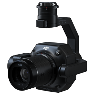
DJI Zenmuse P1
The DJI Zenmuse P1 is a full-frame photogrammetry camera payload designed for high-precision aerial mapping needs...
More
DJI Terra Post Processing Software
DJI Terra is a drone data processing software (photogrammetry & LiDAR) developed by DJI to convert aerial data into 2D maps, 3D models, and geospatial analysis quickly and accurately...
More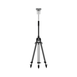
DJI D-RTK 3 Multifunctional Station
The DJI D-RTK 3 is a multi-function GNSS base station designed to provide high-precision (centimeter-level) positioning for DJI drones and extend communication range in field operations...
More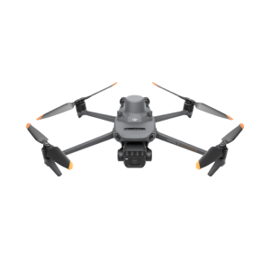
DJI Mavic 3 Multispectral
The DJI Mavic 3 Multispectral (Mavic 3M) is an enterprise drone designed specifically for precision agriculture and vegetation analysis based on multispectral data...
More