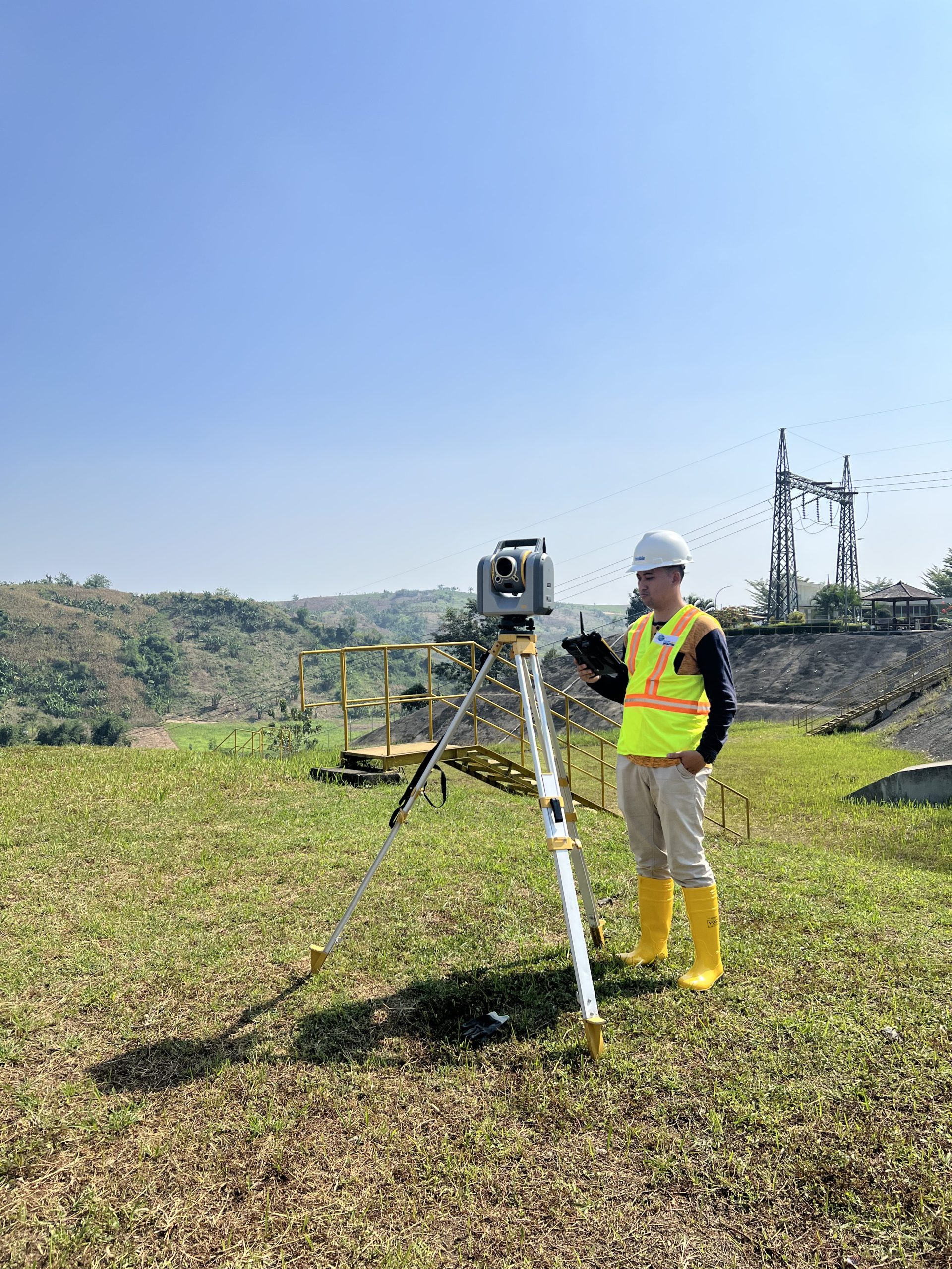
Experienced and Competent Team
With our experience and expertise, we are ready to support the smooth running of your project.


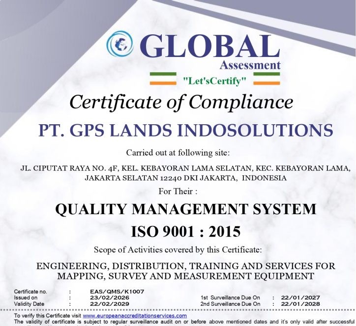
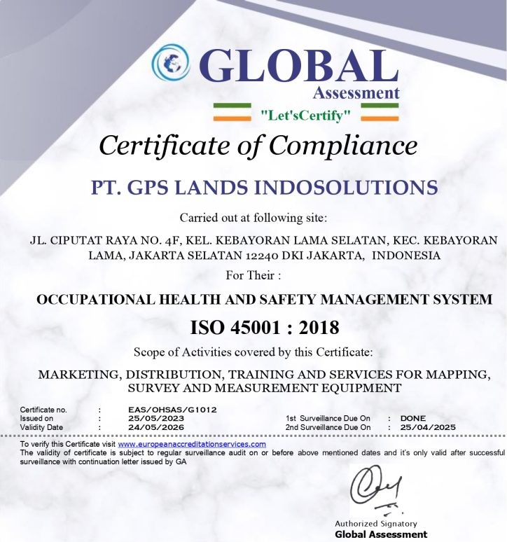
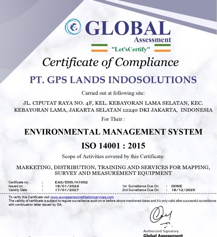
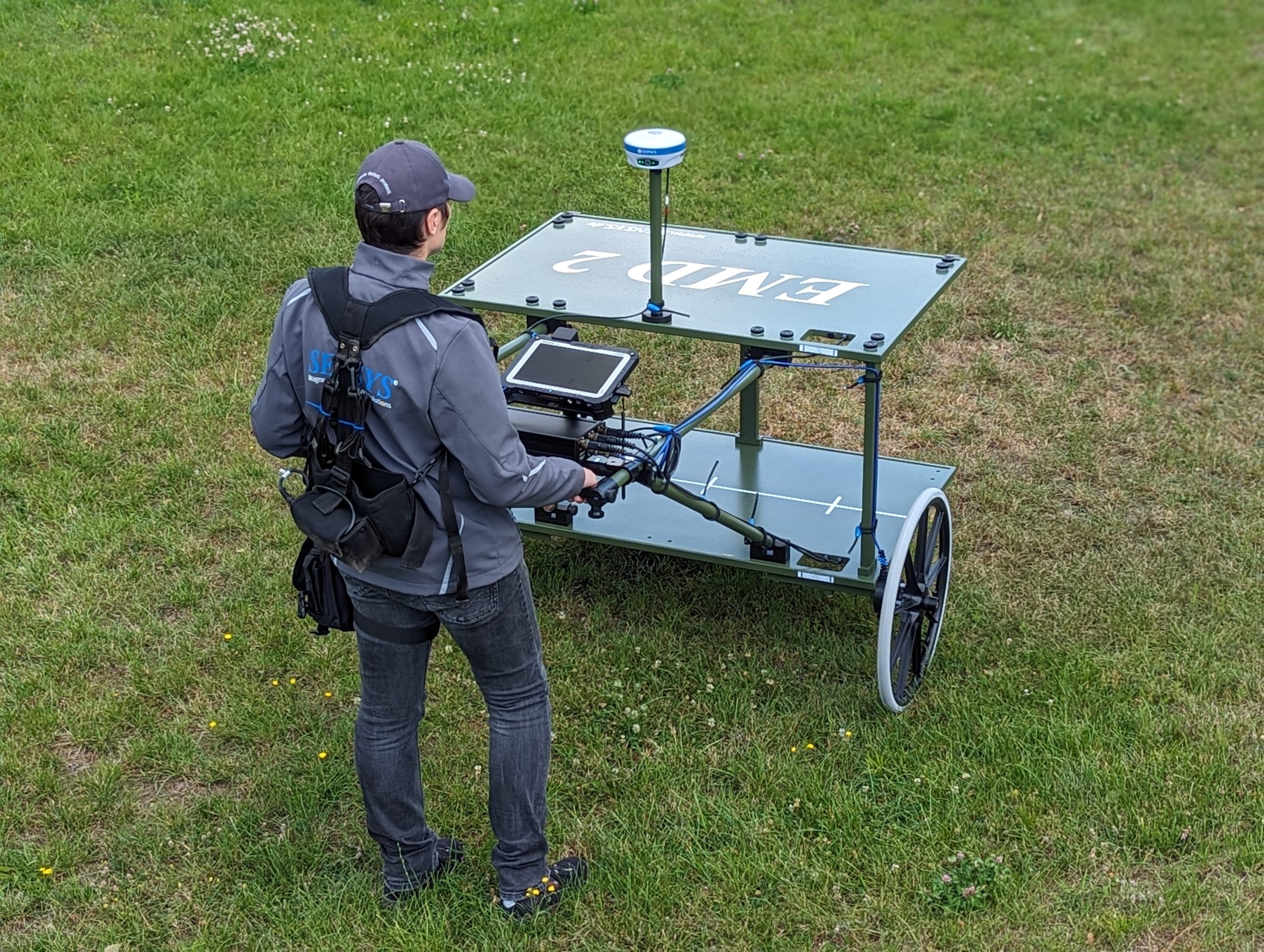
PT GPS Lands Indosolutions is a provider of surveying and mapping equipment solutions established in Jakarta on July 12, 2006. As an authorized distributor and dealer for Trimble Geospatial, Trimble Advance Positioning, DJI Enterprise, Loadsensing, Geosense, Vaisala, Agisoft, Pix4D, and Terrasolid, we provide repair, calibration, and training services for product users.
Our workshop is accredited by KAN SNI ISO/IEC 17025 and ISO 9001, supported by certified technicians, and offers comprehensive services including warranty, spare parts, and pick-up and drop-off. With ISO 9001 quality management standards, we are committed to being the partner of choice, supporting our clients' work with the latest surveying and mapping technology.
To be a trusted surveying and mapping company that excels in data accuracy, technology, and service quality to support the success of every client project.
With our experience and expertise, we are ready to support the smooth running of your project.
Supported by a professional team with technical expertise and official certification in the fields of surveying, mapping, and geospatial technology.


We evolve as client trust and project challenges continue to change.

PT GPS Lands Indosolutions was founded on July 12, 2006, in Jakarta, as a company focused on providing surveying, mapping, and geospatial technology solutions in Indonesia. Since its inception, the company has been committed to supporting geospatial professionals by providing accurate, reliable, and efficient survey technology.

In its early development phase, GPS Lands Indosolutions actively introduced various GNSS technologies and modern survey equipment to the Indonesian market. The company began building partnerships with various parties, including survey consultants, contractors, academics, and government agencies.

As the need for spatial data management increases, the company expands its product portfolio by providing mapping software and GIS solutions, which enable users to manage, process, and analyze geospatial data more effectively.

GPS Lands Indosolutions is strengthening its technical support services and training programs for customers. This initiative aims to ensure that every user can maximize the use of their surveying and mapping technology.

Companies are beginning to offer integrated survey solutions, combining field hardware with data processing software. This enables more efficient workflows, from data collection to analysis and modeling.

As UAV technology advances, GPS Lands Indosolutions is expanding its solutions by introducing drone technology for aerial mapping. This technology enables faster and more efficient data collection for various industries such as mining, infrastructure, plantations, and construction.
In response to global changes and increasingly dynamic industry needs, the company has begun developing digital training programs, remote technical support, and online consultations, enabling customers across Indonesia to continue receiving optimal service.
Currently, GPS Lands Indosolutions provides end-to-end geospatial solutions, including: Survey and positioning technology Mapping solutions using drones Geospatial data processing software Technical training and professional consulting These solutions are used by various industrial sectors such as mining, construction, infrastructure, plantations, education, and government agencies.

GPS Lands Indosolutions terus memperkuat posisinya dengan menghadirkan berbagai solusi yang mengintegrasikan teknologi GNSS, pemetaan udara berbasis drone, serta software pengolahan data geospasial untuk mendukung kebutuhan industri modern.