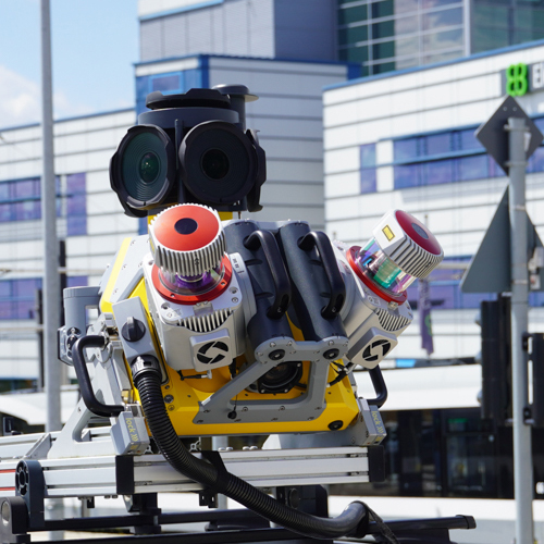
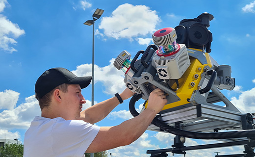
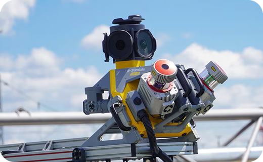
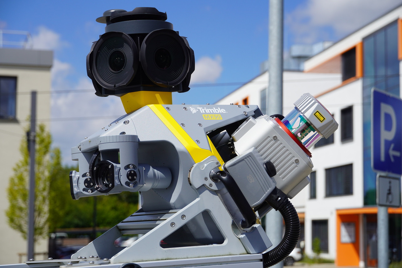


Trimble MX90 Mobile Mapping System
- Elevate your large-scale scanning and mobile mapping
- High-resolution immersive imagery for feature detection and inspection tasks
Ready to start your project?
Contact us today for a free consultation and the best solution.
Description
The Trimble MX90 is a mobile mapping system (MMS) designed to capture 3D geospatial data with high accuracy and efficiency while moving. Typically mounted on a mobile platform such as a land vehicle, the system incorporates a combination of GNSS sensors, IMUs, immersive cameras, and laser scanners to enable fast, accurate, and detailed environmental mapping.
Mobile mapping with the Trimble MX90 enables organizations to capture large-scale 3D data without having to stop or perform static scanning, making it ideal for highway surveys, corridor mapping, utility infrastructure, city mapping, and intelligent transportation applications.
SPECIFICATION
DOWNLOAD
Want to see more detailed specifications?
Download the full specifications PDF file via the link below.
General Questions
Trimble MX90 adalah sistem mobile mapping berbasis kendaraan yang menggabungkan sensor GNSS, IMU, kamera resolusi tinggi, dan laser scanner 3D untuk menangkap data geospasial secara akurat saat kendaraan bergerak.
-
Pengambilan data tanpa berhenti (mobile)
-
Produktivitas jauh lebih tinggi
-
Cakupan area luas dalam waktu singkat
-
Kombinasi point cloud dan imagery resolusi tinggi
-
Mengurangi kebutuhan personel di lapangan
-
Dengan integrasi GNSS + IMU kelas survei dan sistem kalibrasi presisi, MX90 mampu menghasilkan akurasi posisi tingkat sentimeter (tergantung metode koreksi GNSS dan kondisi lingkungan).
Trimble MX90 umumnya dilengkapi dengan:
-
GNSS receiver presisi tinggi
-
IMU (Inertial Measurement Unit)
-
Laser scanner 3D
-
Kamera multi-arah resolusi tinggi
Ya. Sistem GNSS/INS yang terintegrasi memungkinkan pengumpulan data tetap stabil di area urban canyon, meskipun kualitas GNSS tetap dipengaruhi oleh kondisi lingkungan sekitar.
MX90 sangat ideal untuk:
-
Pemetaan jalan raya & koridor
-
Perencanaan kota
-
Inventarisasi aset jalan & utilitas
-
Infrastruktur transportasi
-
Proyek smart city
-
Dokumentasi as-built skala besar
Still unsure about choosing the right product?
Contact us today for a free consultation and the best solution.
Free Consultation