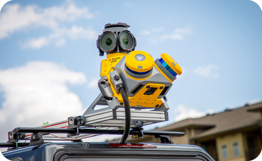


Trimble MX60 Mobile Mapping System
- Powerful mobile scanning
- Imaging for asset management
Ready to start your project?
Contact us today for a free consultation and the best solution.
Description
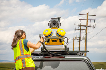
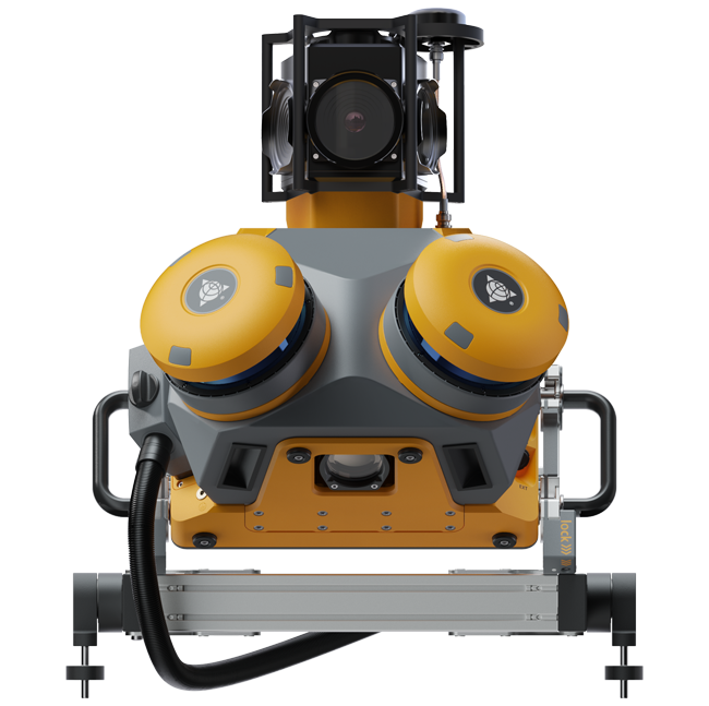
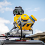
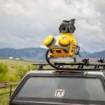
The Trimble MX60 is a next-generation mobile mapping system designed to efficiently capture high-quality 3D geospatial data while on the move. Equipped with GNSS sensors, an IMU, a high-resolution camera, and an integrated laser scanner, the MX60 is an ideal solution for corridor surveys, roadways, utility mapping, transportation asset management, and large-scale Smart City and Digital Twin initiatives.
Unlike static systems, the MX60 allows data collection in parallel with vehicle movement, saving fieldwork time and speeding up the process of mapping large areas without sacrificing accuracy.
SPECIFICATION
DOWNLOAD
Want to see more detailed specifications?
Download the full specifications PDF file via the link below.
General Questions
Trimble MX60 adalah sistem mobile mapping berbasis kendaraan yang menggabungkan GNSS presisi tinggi, IMU, kamera resolusi tinggi, dan laser scanner 3D untuk menangkap data geospasial saat kendaraan bergerak.
-
Pengumpulan data tanpa berhenti (mobile workflow)
-
Produktivitas tinggi untuk koridor panjang
-
Kombinasi point cloud + imagery resolusi tinggi
-
Integrasi sensor presisi untuk akurasi spasial
-
Cocok untuk proyek skala kota hingga nasional
-
Dengan integrasi GNSS dan IMU kelas survei, MX60 mampu menghasilkan akurasi posisi tingkat sentimeter (tergantung metode koreksi GNSS dan kondisi lingkungan saat survei).
Sistem MX60 umumnya mencakup:
-
GNSS receiver presisi tinggi
-
IMU (Inertial Measurement Unit)
-
Laser scanner 3D
-
Kamera multi-arah resolusi tinggi
MX60 sangat ideal untuk:
-
Pemetaan jalan & koridor
-
Inventarisasi aset jalan
-
Mapping utilitas
-
Smart city & digital twin
-
Dokumentasi as-built infrastruktur
Secara umum:
-
MX90 berada di kelas lebih tinggi untuk kebutuhan akurasi dan sensor premium
-
MX60 menawarkan keseimbangan antara performa, fleksibilitas, dan investasi yang lebih efisien
Still unsure about choosing the right product?
Contact us today for a free consultation and the best solution.
Free Consultation