
Mining
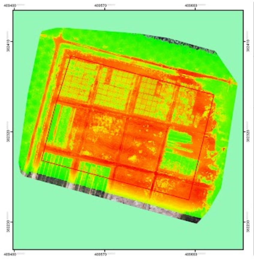
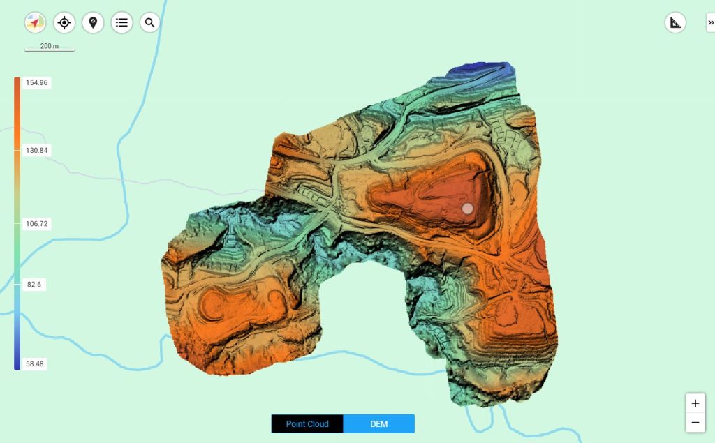
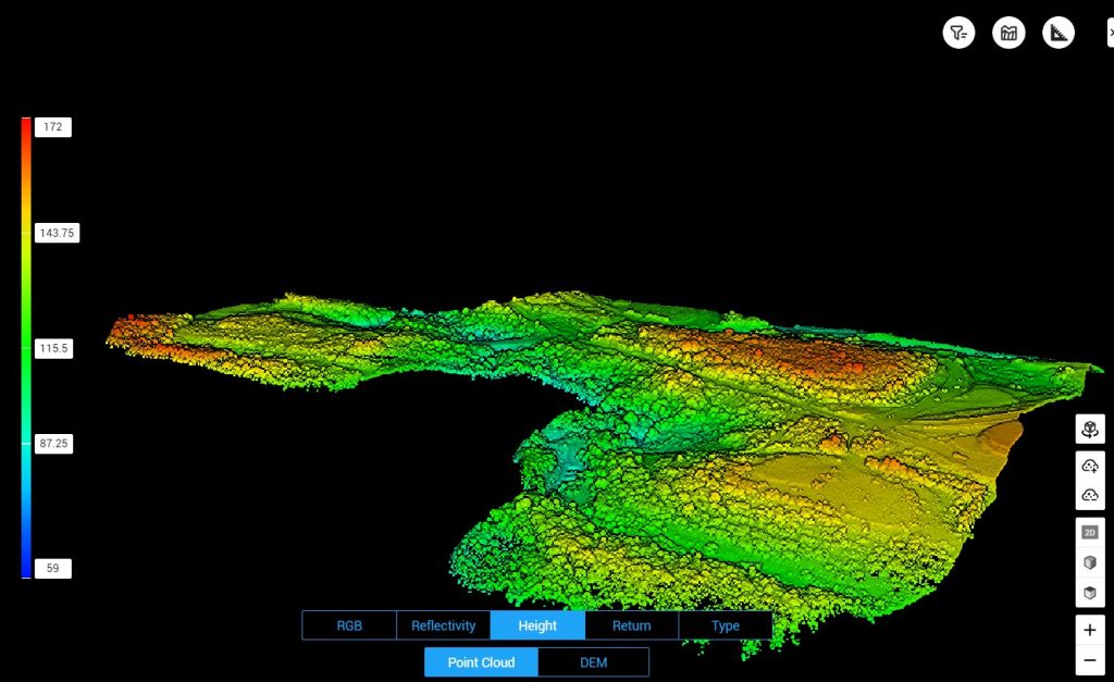
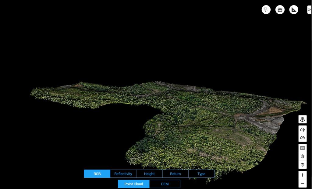
For the mining industry, we provide mining area mapping, excavation and stockpile volume measurements, and work area monitoring. Accurate survey data is crucial for resource management and mine operational planning.
With a structured approach, we help mining companies improve operational efficiency, workplace safety, and compliance with applicable regulations.
Mining Products
All Products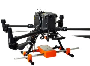
Zond Aero LF — Aerial Low-Frequency
Zond Aero LF adalah sistem survei geofisika udara berbasis low-frequency electromagnetic yang dirancang untuk mengidentifikasi anomali bawah permukaan seperti mineral berharga, struktur geologi, dan zona mineralisasi yang terpendam...
More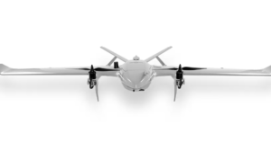
Drone VTOL Raybe
Drone VTOL RAYBE dirancang untuk tantangan pemetaan udara yang kompleks di medan yang sulit...
More
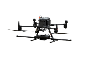
MagDrone R3
MagDrone R3 adalah sistem magnetometer udara berbasis drone yang dirancang untuk melakukan survei magnetik beresolusi tinggi di berbagai aplikasi geospasial...
More