


Terrasolid – Post Processing Software
- Point Cloud Intelligence
- Versatile and Capable Tools
Ready to start your project?
Contact us today for a free consultation and the best solution.
Description
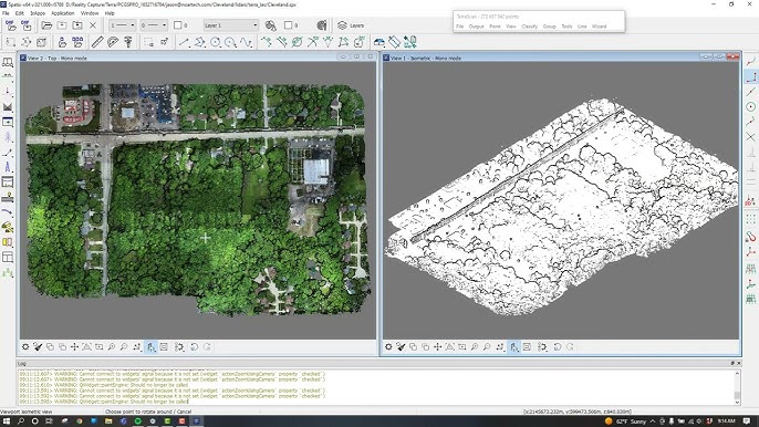
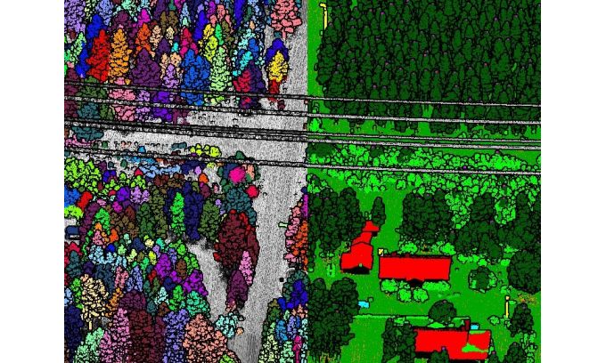
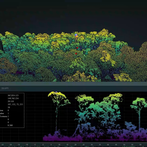
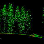
Terrasolid is a professional software for large-scale LiDAR data processing and analysis, widely used in topographic mapping, corridor mapping, forestry, electricity, mining, and infrastructure projects.
This software is known as one of the global industry standards for aerial and mobile mapping-based LiDAR point cloud processing.
SPECIFICATION
DOWNLOAD
Want to see more detailed specifications?
Download the full specifications PDF file via the link below.
General Questions
Terrasolid is a professional software for processing and analyzing LiDAR (point cloud) data used in topography, corridor mapping, forestry, and large-scale infrastructure projects.
Digunakan untuk:
- LiDAR airborne (pesawat / drone)
- Mobile mapping LiDAR
- Terrestrial LiDAR
- Format LAS/LAZ dan point cloud lainnya
Tidak secara utama. Terrasolid difokuskan untuk data LiDAR.
Untuk photogrammetry lebih cocok menggunakan:
- Pix4Dmapper
- Agisoft Metashape
- DJI Terra
Ya. Dengan modul TerraModeler, pengguna dapat:
- Membuat DTM
- Generate kontur otomatis
- Membuat breakline
- Analisis permukaan
TerraScan adalah modul utama untuk:
- Import & manajemen point cloud
- Klasifikasi otomatis (ground, vegetation, building, powerline)
- Editing & cleaning data
- Filtering noise
Still unsure about choosing the right product?
Contact us today for a free consultation and the best solution.
Free Consultation