


PIX4D Post Processing Software
- Reliable photogrammetry software for classic drone mapping
- Plant Health Monitoring Software
Ready to start your project?
Contact us today for a free consultation and the best solution.
Description
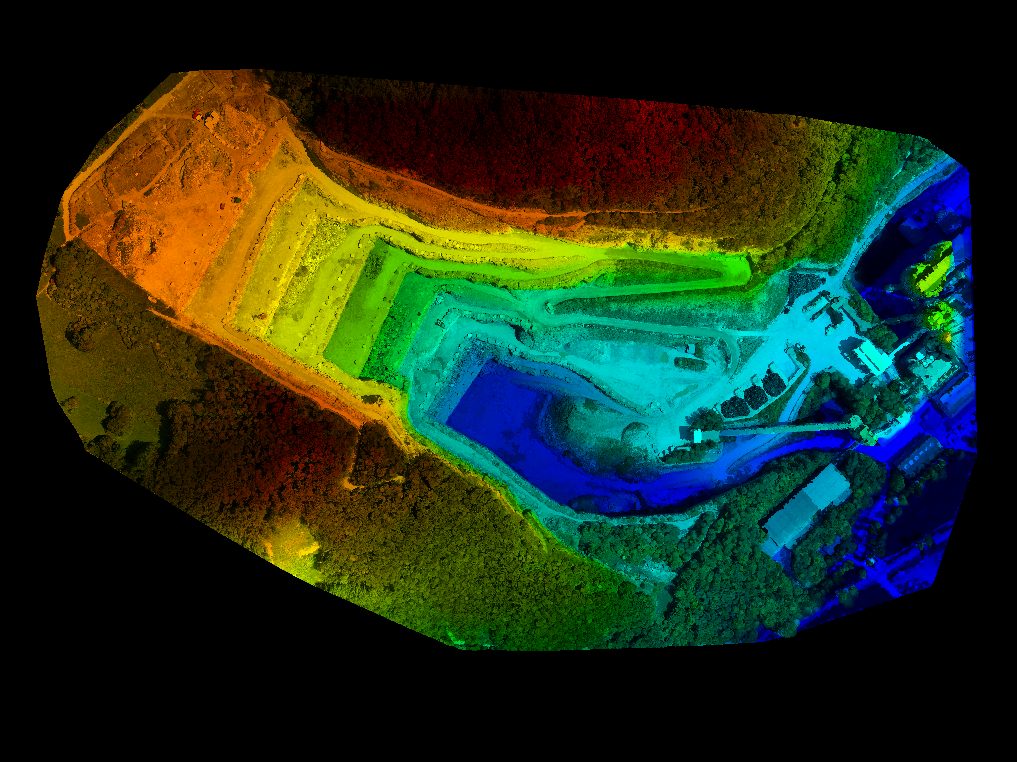
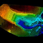
Pix4Dmapper (PIX4D) is a professional photogrammetry software used to process aerial and terrestrial photos into 2D maps, 3D models, point clouds, DSMs, and DTMs with high accuracy. This software is widely used in the surveying & mapping, construction, mining, agriculture, and infrastructure industries.
PIX4D works using the Structure from Motion (SfM) and Multi-View Stereo (MVS) methods to reconstruct objects or areas into image-based 3D models.
SPECIFICATION
DOWNLOAD
Want to see more detailed specifications?
Download the full specifications PDF file via the link below.
General Questions
PIX4D is a professional photogrammetry software for processing photos into highly accurate orthomosaics, DSMs, DTMs, point clouds, and 3D models.
Digunakan untuk:
- Survey & mapping topografi
- Perhitungan volume stockpile
- Monitoring progres proyek
- Corridor mapping
- Pertanian presisi
- Dokumentasi 3D
Tidak. PIX4D kompatibel dengan:
- Drone DJI
- Autel
- Parrot
- Kamera DSLR / mirrorless
- Kamera multispektral
Tidak tergantung satu brand.
Ya. Metashape mendukung:
- Input koordinat RTK/PPK
- Import GCP (Ground Control Point)
- Analisis error & laporan akurasi
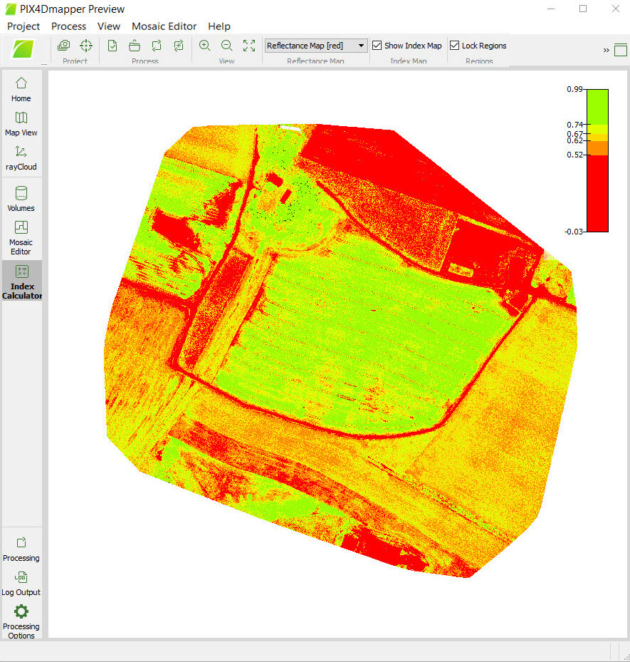
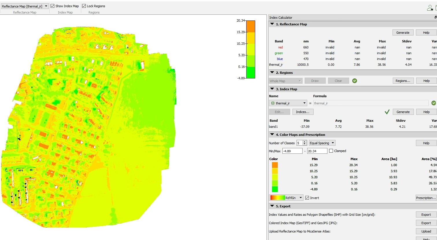
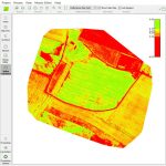
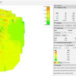
Ya. PIX4D dapat:
- Mengolah citra multispektral
- Menghasilkan NDVI dan indeks vegetasi lainnya
- Digunakan untuk analisis pertanian
Still unsure about choosing the right product?
Contact us today for a free consultation and the best solution.
Free Consultation